


GRANDVILLE Voting District, Jasper County, Illinois
About
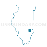
Outline

Summary
| Unique Area Identifier | 571288 |
| Name | GRANDVILLE Voting District |
| County | Jasper County |
| State | Illinois |
| Area (square miles) | 36.99 |
| Land Area (square miles) | 36.99 |
| Water Area (square miles) | 0.00 |
| % of Land Area | 99.99 |
| % of Water Area | 0.01 |
| Latitude of the Internal Point | 39.13483110 |
| Longtitude of the Internal Point | -88.00170500 |
Maps


Graphs
Select a template below for downloading or customizing gragh for GRANDVILLE Voting District, Jasper County, Illinois


Neighbors
Neighoring Voting District (by Name) Neighboring Voting District on the Map
- CROOKED CREEK Voting District, Cumberland County, IL
- CROOKED CREEK 1 Voting District, Jasper County, IL
- HUNT CITY Voting District, Jasper County, IL
- JOHNSON Voting District, Clark County, IL
- LICKING 1 Voting District, Crawford County, IL
Top 10 Neighboring County Subdivision (by Population) Neighboring County Subdivision on the Map
- Crooked Creek township, Jasper County, IL (721)
- Licking township, Crawford County, IL (448)
- Crooked Creek township, Cumberland County, IL (422)
- Johnson township, Clark County, IL (383)
- Grandville township, Jasper County, IL (372)
- Hunt City township, Jasper County, IL (282)
Top 10 Neighboring Place (by Population) Neighboring Place on the Map
Top 10 Neighboring Unified School District (by Population) Neighboring Unified School District on the Map
- Jasper County Community Unit School District 1, IL (9,346)
- Casey-Westfield Community Unit School District 4C, IL (6,073)
- Oblong Community Unit School District 4, IL (3,985)
Top 10 Neighboring State Legislative District Lower Chamber (by Population) Neighboring State Legislative District Lower Chamber on the Map
Top 10 Neighboring State Legislative District Upper Chamber (by Population) Neighboring State Legislative District Upper Chamber on the Map
Top 10 Neighboring 111th Congressional District (by Population) Neighboring 111th Congressional District on the Map
Top 10 Neighboring Census Tract (by Population) Neighboring Census Tract on the Map
- Census Tract 9724, Cumberland County, IL (3,190)
- Census Tract 8801, Crawford County, IL (2,871)
- Census Tract 9773, Jasper County, IL (2,799)
- Census Tract 604, Clark County, IL (1,793)
Top 10 Neighboring 5-Digit ZIP Code Tabulation Area (by Population) Neighboring 5-Digit ZIP Code Tabulation Area on the Map
- 62448, IL (5,834)
- 62420, IL (4,759)
- 62449, IL (3,175)
- 62428, IL (3,104)
- 62480, IL (787)
- 62432, IL (571)
- 62481, IL (386)